GIS Tip #003
My Take
Keep Your GIS Data Clean, Accurate and Reliable
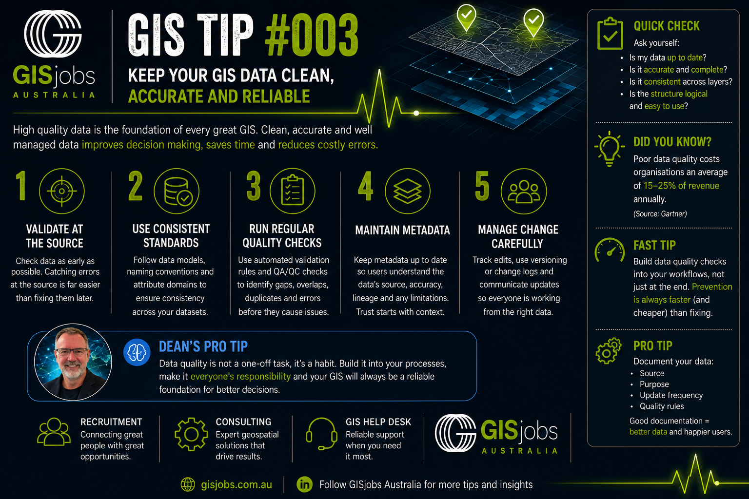
Every great GIS starts with great data.
It doesn't matter how powerful your software is or how impressive your maps look, if the underlying data isn't accurate, every decision built on it becomes less reliable.
Over the years, I've found that organisations with the most successful GIS programs have one thing in common...
They treat data quality as an ongoing process, not a one-off exercise.
Here are five simple habits that can make a huge difference:
✅ 1. Validate Data at the Source
It's always easier (and cheaper) to prevent errors than to fix them later. Capture accurate data from the beginning wherever possible.
✅ 2. Use Consistent Standards
Naming conventions, domains, coding standards and agreed data models help ensure everyone is working in the same way.
✅ 3. Run Regular Quality Checks
Look for duplicates, missing attributes, geometry errors and topology issues before they become larger problems.
✅ 4. Maintain Your Metadata
Good metadata explains where the data came from, how current it is and any limitations users should be aware of. Trust starts with context.
✅ 5. Manage Change Carefully
Every edit matters. Use versioning, change logs and review processes to keep your data reliable as it evolves.
🧠 Dean's Pro Tip
One lesson I've learned over the years is this:
Data quality isn't a project. It's a culture.
When everyone in the organisation takes ownership of data quality, not just the GIS team, the entire business benefits.
Good data leads to better decisions.
Better decisions lead to better outcomes.
📊 Did You Know?
Research consistently shows that poor data quality can have a significant impact on organisations through rework, inefficiency and poor decision-making. Building simple quality checks into your workflows is almost always more cost-effective than fixing issues after the data has been used.
💬 Question for the community
What's the most common data quality issue you encounter in your GIS?
Missing attributes?
Duplicate features?
Incorrect locations?
Out-of-date information?
Something else?
I'd love to hear your experiences, and how you've tackled them.
💡 Small improvements, applied consistently, make great GIS systems.
GISjobs Australia
Recruitment • Consulting • GIS Help Desk
Helping Australia's GIS community solve problems, build capability and find great people.

A considered approach to hiring valued by those who rely on it.
Built for the geospatial industry.
Connected to the people within it.
1 / 5
What our clients say:
"I've known Dean since the early 90's when I was one of his GIS lecturers at UQ. Since then, he has grown GISJobs from scratch to make it one of the most respected GIS career placement sites on the planet."

Graeme Brooke
Owner - VizMAP
"Dean's knowledge of the geospatial market in the Asia/Pacific area unmatched.
I highly recommend his work and business ethics."
Joe Francica
Geospatial Tech Sector
"Dean is a collaborative style of person that is not afraid to step outside the square. I would recommend his services as he has a committment to continuous improvement and recruitment best practice."
Kim Arnott
Stakeholder Engagement
"Dean's experience in the geo-spatial industry has made him talented in the field of Cartography and GIS. Wonderful sense of customer relationship and development."
Srikant Panda
GeoCloud
"Dean's experience and professionalism had a positive impact on our GIS and mapping projects at SLA and I highly recommend him for any future opportunities."
Tom Gillberg
Digital Marketing Man.
"Dean's insights, support & encouragement have motivated me to keep improving and stay focused on my goals. Highly recommend him for his genuine support and expertise."
Bhuban Timalsina
Asset & Spatial Data Specialist

